
 3D LASER SCANNING
3D laser scanning is a geospatial technology that uses LIDAR (light detection and ranging) to measure the geometry and location of physical locations. Each laser scan emits millions of measurement points, and collectively these points create a “point cloud” of raw geospatial coordinates. The precise detail of these points means that you can accurately measure the dimensions and location of physical objects and structures efficiently and accurately. The result is a highly accurate digitized replica – or digital twin – of your facility, building, or site.
STANDIS is internationally recognized for excellence in the field of 3D laser scanning – working with some of the largest companies in Turkey and Germany. Our scanning technicians are experts at operating terrestrial LIDAR systems and follow a rigorous process that ensures accurate capture and registration of your site. Our dedicated in our Istanbul office team is able to process your raw data at industry leading turnaround times and deliver a high-fidelity product for our project.
Competencies
- Long-range laser scanning
- Short-range laser scanning
- Photogrammetry
- Robotic total stations
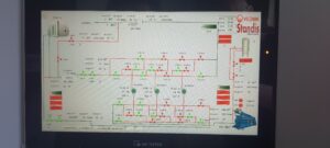
- Rapid data processing
- Data management
- Web portal to access your point cloud
Use Cases
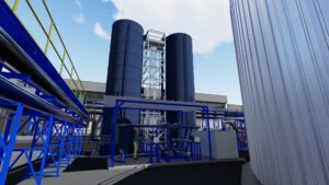
- Oil and gas facilities
- Pulp and paper mills
- Chemical plants
- Food production plants
- Storage facilities
- Power plants
- Mining facilities
- Heritage sites
- Civil infrastructure
- Public facilities
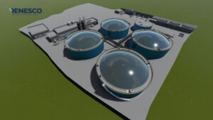
- Wastewater facilities
- Electrical facilities
- Commercial buildings
- Sport complexes
Technologies
- Robotic Total Stations
- RTK (GPS) Rover and Base
- 3D Laser Scanners
(Long Range + Short Range) - ATV / UTV / Snowmobiles
- Mobile 3D Scanning Units
- Survey / Scanning Trucks
- Mixed Reality Headsets